


Mapping God’s World

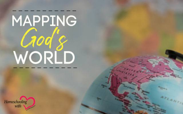
God’s Word tells us that the earth belongs to Him and all the people who live in it (Psalm 24:1), and Jesus told us to make disciples of all nations starting right where we are and moving across the entire world (Matthew 28:19 and Acts 1:8). Best of all, He loves all the people in the entire world so much that He sent Jesus so anyone who believes in Him will have everlasting life (John 3:16)! That’s exciting!
As a homeschool mom, I want to teach my children about the world God made and loves. If God calls them to go to Calcutta to share the Gospel, I want them to know where it is!
Mapping the world is a precious part of homeschooling to me because it is God’s world, and by sending Jesus to save it, He is personally invested in it! When we pull out our geography maps, we are mapping God’s world!
Of course, we don’t really know what the world was like before the flood because that was such a major catastrophe. However, we can begin with the world itself as it is today with its oceans, rivers, mountains, and grasslands.
Mapping Landforms Around the World
When my children are little, I like to start with blank outline maps of the entire world. I give them crayons or they dictate to me the names of the continents and the oceans. This is a great starting place for mapping God’s world!
As they get older, they always start the year with a blank outline map labeling continents and oceans. From there we move to famous mountain ranges, rivers, lakes, deserts, and forests.
If they are studying a country for unit study or geography fair, we often make a landform map first.
Here are some of the basic landforms children should be able to map by the time they are starting high school:
- Andes Mountains
- Amazon River
- Patagonian Desert
- Argentinean Pampas
- Amazon Rain Forest
- Nile River
- Congo River
- Sahara Desert
- Kalahari Desert
- Congo Rain Forest
- Ganges River
- Yangtze River
- Tigris River
- Euphrates River
- Jordan River
- Arabian Desert
- Gobi Desert
- Manchurian Plain
- Mongolian Plain
- Kazakh Steppe
- Himalaya Mountains
- Daintree River
- Great Victoria Desert
- Australian Savanna
- Daintree Rain Forest
- Great Dividing Range
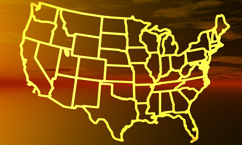
- Mississippi River
- Great Basin Desert
- Canadian Prairies
- American Great Plains
- Rocky Mountains
- Sierra Nevada Mountains
- Danube River
- Rhine River
- Great Hungarian Plain
- Alps
- Caucasus Mountains
- Ring of Fire
When they are studying history, it is a great idea to create landform maps. Ports on rivers and lakes as well as mountains dividing areas play a huge role in history.
Next, we move on to the most popular of all maps.
Political Mapping
It is so fun to look at a globe and explore an atlas to see all the nations on the earth. There are so many!
Political maps show the political borders of the nations on a continent or in the whole world. In a national map, boundaries show the states or districts of a country.
With so many different nations around the world, making political maps can be challenging.
One thing I like to do is have my children play an online geography games site called Seterra, which is free. It really helps my children learn all the nations in a continent or around the world. In fact, whenever I teach geography, I play these games for a few weeks until I know all my nations again.
You can play for free here.
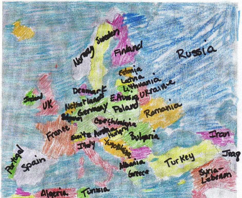
When we map continents or the world using a blank outline map with borders drawn but empty, I have my children fill in the names of each country and put a star inside for the capital and write the name of the capital.
Of course, we have to look at flags and find photos online of the countries we are mapping!
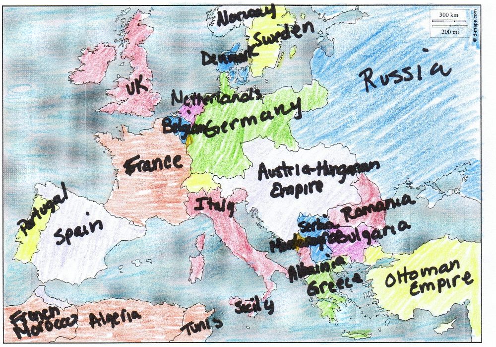
Mapping Political Boundaries
Political boundaries are always changing. So, it is really fun for children to see overlapping maps with the different political boundaries.
For example, the Austrian empire was huge, but after World War I, brand new countries appeared and older nations reappeared. Landforms stayed the same, but political boundaries changed.
Whenever we study World War I, we always study before and after maps because the political boundaries of nations completely changed! From huge empires to small nations, the map looks completely different. Yet, there is that familiarity of the mountains, rivers, oceans, and lakes.
When the Ottoman Empire fell after World War I, nations like Yemen, Iraq, Syria, and Kuwait were created.
Pre & Post World War I Maps Children Made from Blank Outline Maps
More Mapping
Though political and landform maps are the most popular, there are many other kinds of maps including economic maps, natural resources maps, time zone maps, language maps, religion maps, and weather maps. We could go on and on with different kinds of mapping. You can map world or national climate, economies, roads, shipping routes, flight patterns, agriculture, minerals, elevation, and so many more.
Traveling is the perfect time to use road maps. I still keep an atlas in my car. Yes, I know I’m old-fashioned, but I love looking at the map while my husband is driving. Children enjoy planning routes and seeing if there are other ways to get to the destination.
Resource maps are really fun for children to do, especially when they create their own symbols for them. God has given each nation treasure like iron ore, petroleum, natural gas, coal, gold, silver, titanium, nickel, forests, farmland, and rivers. It’s fun to make a world map and see where most of the gold is or who has the most farmland.
When we make religion maps, we can see where the Gospel has never been and where the light of the Gospel is waning. Of course, there are areas where the Gospel is thriving and growing too. The 10-40 Window is an area in Asia between lines of 10 degrees north and 40 degrees north in Northern Africa, Asia, and the Middle East where many people have not heard the Gospel yet.
Mapping can lead to prayer for those who need to be saved. It’s fun to research a country and then pray for that country, especially for folks to be reached with the Gospel.
Silly Mapping
Mapping doesn’t always have to be serious. You can map countries that have McDonald’s restaurants within their borders. Or the most popular candy in each nation.
You can make maps of your bedroom, house, or city with all your favorite things in it.
Children can make treasure maps and the rest of the family has to find the treasure by following the map.
You can make a map without a legend so people have to guess what the symbols stand for.
You can set a timer for 60 seconds and have everyone draw a map of the world. Everyone will get a good laugh at these maps!
Or you can map the world on the bathroom wall! We did that and we have the greatest master bath ever!
Here are some resources to help you with mapping.
Resources:
Mapping the Bathroom Wall blog post
Ingredients of a Map blog post
Our Family’s Favorite Resources for World Geography blog post
Until next time, Happy Homeschooling,
Warmly,
Meredith Curtis
Meredith Curtis, homeschooling mom, writer, speaker, and publisher, loves to encourage families in their homeschooling adventure. She is the author of Travel God’s World Geography, Travel to London Unit Study, Travel God’s World Cookbook, and HIS Story of the 20th Century. You can check out her books, curricula, unit studies, and Bible studies at PowerlineProd.com. Free Reading Lists for all ages are available at JSHomeschooling.com. Read her blogs at MeredithCurtis.com and PowerlineProd.com and listen to her at Finish Well Radio.
Share this on Pinterest!


SHARE TOS ON YOUR PAGE!
GRAB OUR BUTTON HERE-
![]()